

Behind the Scenes with the WVDNR’s Geographic Information Systems Team
Behind every successful hunting trip, fishing expedition and wildlife conservation effort in West Virginia is the often unseen work of the WVDNR’s Geographic Information Systems (GIS) team. From tracking wildlife populations to creating an interactive hunting and fishing map, this small, but vital group of experts supports the WVDNR’s mission by managing data, creating detailed maps and maintaining public resources that empower outdoor enthusiasts and conservationists alike.
What is Geographic Information Systems?
Geographic Information Systems (GIS) is a technology for capturing, analyzing and visualizing spatial data. While GIS has broad applications across many industries, this technology is particularly valuable in wildlife management. GIS allows agencies like the WVDNR to track animal movements, model potential conservation zones, identify critical habitat, predict species distribution, assess development impacts and estimate population sizes, which informs conservation strategies and makes allocating resources more effective.
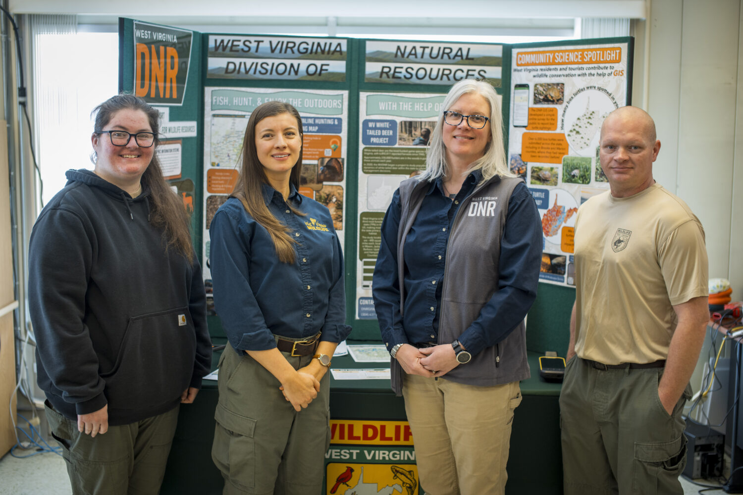
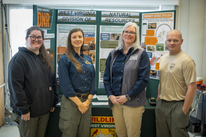
Jessica Perkins, GIS and Technical Support Program Manager for the WVDNR, explains the broad scope of work: “We support all units within Wildlife Resources with spatial data needs, other non-spatial data needs and mapping.” Beyond its technical benefits, GIS also makes data accessible through visual tools like maps, allowing collaboration between researchers, wildlife managers and other stakeholders. This accessibility benefits not only conservationists but also members of the hunting and fishing public.
Mapping the Way to Conservation
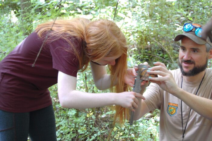
Through the use of this technology, the WVDNR GIS team plays a key role in supporting the agency’s Wildlife Resources Section. They create accessible maps, maintain data systems and equip field staff with tools such as ArcGIS and high-accuracy GPS units to improve field data collection and conservation practices.
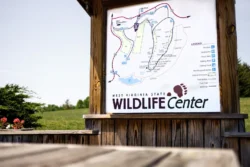
One of their most popular tools are Wildlife Management Area (WMA) handout maps and the WVDNR’s interactive online hunting and fishing map. Handout maps are designed to help hunters navigate WMAs and stay informed about changes in field conditions, says Jeremy Rowan, a GIS Technician for the WVDNR. The interactive online hunting and fishing map offers detailed information about public hunting lands and waterways, says Meryl Friedrich, a GIS Programmer Analyst for the WVDNR. Making sure these maps remain accurate helps hunters and anglers make the most of their time in the field.
Where Science Meets the Great Outdoors
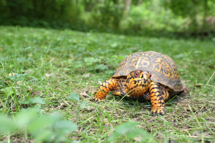
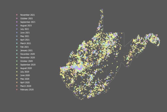
The GIS team’s work doesn’t stop with maps. The team plays a crucial role in supporting the electronic licensing system and citizen science projects, which connect the public to conservation efforts. “The DNR hosts several citizen science opportunities,” says Brandy Bachman, a GIS Programmer Analyst for the WVDNR. “This includes the recent box turtle survey where we asked the public for sightings of box turtles. We had more than 8,000 observations for that turtle survey in two years, which was phenomenal.”
This initiative led to the development of a habitat map for box turtles across West Virginia, identifying areas where they are most at risk from vehicle collisions. Similar citizen science projects are underway for species like hellbenders, mud puppies, river otters, and fireflies. As Bachman explains, “We have a myriad of ways for the public to get involved in what the DNR is doing.”
These contributions are vital to the WVDNR’s State Wildlife Action Plan, which prioritizes the management of non-game species, including rare, threatened and endangered animals. By combining public input with data-driven strategies, the GIS team helps guide meaningful conservation initiatives across the state.
Explore, Engage and Make a Difference
The GIS team remains a cornerstone of the WVDNR’s mission. Their work bridges the gap between science and the great outdoors, so hunters, anglers and conservationists alike have the tools and information they need to enjoy and protect West Virginia’s natural resources.
The work of the WVDNR’s GIS team is vital to the conservation of West Virginia’s natural resources and the enhancement of outdoor experiences for hunters, anglers, and nature lovers. You can support their efforts by participating in a citizen science survey or using the WVDNR’s online hunting and fishing map to plan your outdoor adventures.
Want to see more from our team? Save West Virginia DNR as a preferred source in Google