

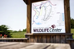
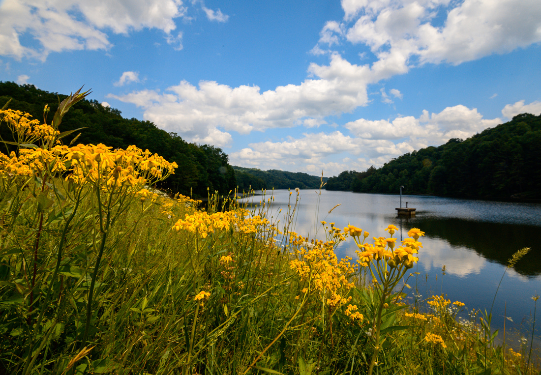
West Virginia’s mountainous forest lands are home to some of the most diverse wildlife in the east. The West Virginia Division of Natural Resources maintains 96 wildlife management areas (WMAs) all over the state, providing visitors and residents with undisturbed hunting, fishing and other outdoor recreation.
West Virginia Wildlife Management Areas
Statewide Wildlife Management Program
The Statewide Wildlife Management Program is designed to conserve and manage high quality habitats for a variety of wildlife species and to improve public access to these resources. Management activities on state and national forest lands include planting of trees and shrubs for food and cover, the establishment of wildlife habitat, maintenance of food plots, and the development of wetlands. In addition to conserving and managing high quality wildlife habitat, development projects improve public access and recreational opportunities. Construction of roads, parking lots, trails, and public shooting ranges are vitally important to wildlife management programs.
Wildlife Management Area Acquisitions
The acquisition of Wildlife Management Areas (WMAs) in West Virginia is a critical component of the Wildlife Resources Section’s effort to fulfill its mission to the citizens of West Virginia. Spurred by the decline in public access to private land and by the continued destruction of critical habitats, the WMA Program enables wildlife biologists to conserve and manage habitat to benefit all wildlife species. At the present time, 1.4 million acres, representing eight percent of the state’s total land area are managed by the Wildlife Resources Section for public wildlife associated recreation.
Physically Challenged Hunters
Providing hunting access for the state’s physically challenged is a priority of the Wildlife Resources Section. District biologists work with local and national advocacy organizations to modify public use facilities and develop innovative programs that address the needs of physically challenged hunters. Within the next 10 years, the Wildlife Resources Section plans on developing an additional 20 trails on WMAs for the use and enjoyment by the state’s physically challenged.
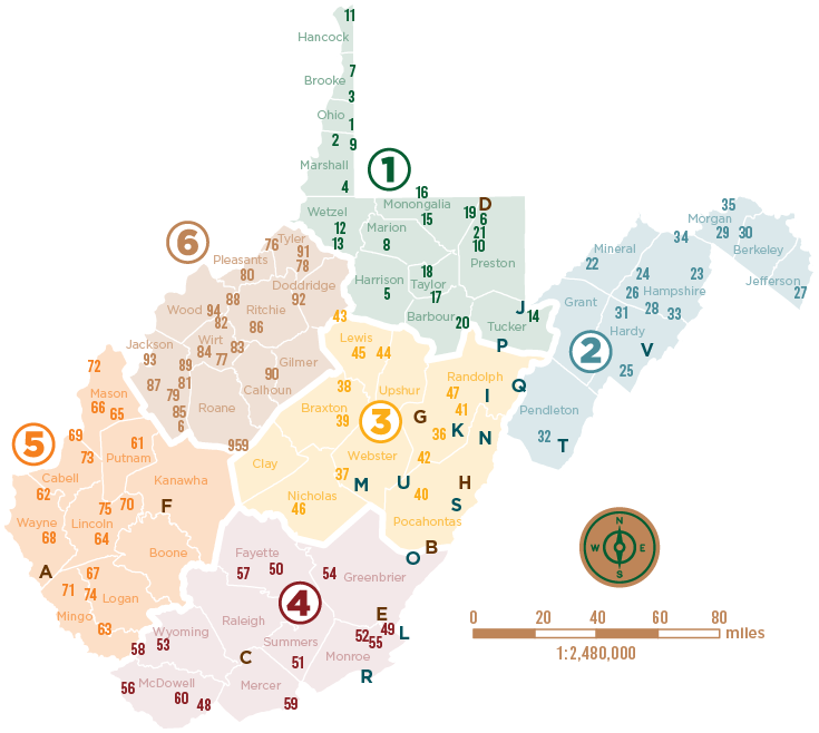
District 1
Ohio
- Bear Rock Lakes
Marshall
2. Burches Run
10. Dunkard Fork
Brooke & Ohio
3. Castlemans Run Lake
Marshall & Wetzel
4. Cecil H. Underwood
Harrison
5. Center Branch
Brooke
6. Cheat Canyon
7. Cross Creek
Hancock
11. Hillcrest
Wetzel
12. Lantz Farm & Nature Preserve
13. Lewis Wetzel
Monongalia
17. Teter Creek
15. Little Indian Creek
16. Pedlar
Barbour & Taylor
17. Pleasant Creek
Taylor
18. Pruntytown State Farm
Monongalia & Preston
19. Snake Hill
Barbour
20. Teter Creek
Preston
10. Fairfax Pond-Rehe
21. Upper Deckers Creek
Marion
8. Dents Run
Tucker
14. Little Canaan
District 2
Mineral
22. Allegheny
Hampshire
23. Edwards Run
24. Fort Mill Ridge
26. Nathaniel Mountain
28. Short Mountain
34. White Horse Mountain
Jefferson
27. Shannondale Springs
Berkeley & Morgan
30. Sleepy Creek
29. Sideling Hill
Hardy & Hampshire
31. South Branch
Pendleton
32. Thorn Creek
Hardy
25. Lost River
33. Warden Lake
Morgan
35. Widmeyer
District 3
Randolph
36. Becky Creek
35. Huttonsville
47. Valley Bend
Webster
37. Big Ditch
Braxton
38. Burnsville Lake
39. Elk River
Pocahontas
40. Handley
Pocahontas & Randolph
42. Slatyfork
Lewis
43. Smoke Camp
45. Stonewall Jackson Lake
Lewis & Upshur
44. Stonecoal Lake
Nicholas
46. Summersville Lake
District 4
McDowell
48. Anawalt Lake
60. Tug Fork
56. Panther
Fayette
45. Beury Mountain
57. Plum Orchard Lake
Summers, Mercer & Monroe
51. Bluestone Lake
Wyoming
53. Horse Creek Lake
Greenbrier
54. Meadow River
Monroe
55. Moncove Lake
49. Andrew Rowan
52. Daniels Ridge
Mingo & Wyoming
58. R.D. Bailey Lake
Mercer
59. Tate Lohr
District 5
Putnam
61. Amherst/Plymouth
Cabell & Wayne
62. Beech Fork Lake
Lincoln
64. Big Ugly
70. Hilbert
75. Upper Mud River
Mason
65. Bright McCausland Homestead
66. Chief Cornstalk
72. McClintic
Wayne
68. East Lynn Lake
Cabell & Mason
69. Green Bottom
Mingo
71 Laurel Lake
63. Big South
Cabell
673 Millcreek
Logan
74. Tomblin
67. Chief Logan
District 6
Tyler
76. Buffalo Run
78. Conway Run Lake
91. The Jug
Jackson
69. Frozen Camp
85. O’Brien Lake
87. Rollins Lake
93. Turkey Run
96. Woodrum Lake
79. Elk Fork Lake
81. Frozen Camp
89. Sandy Creek
Ritchie & Wirt
82. Hughes River
77. Burning Springs
83. Little Kanawha River
84. Lynn Camp
Ritchie
86. Ritchie Mines
Wood & Ritchie
88. Sand Hill
95. Walker Creek
Calhoun & Gilmer
90. Stumptown
Barbour
14. Pleasant Creek
17. Teter Creek
Roane
95. Wallback
Pleasants
80. Federal Ridge
Doddridge
92. Toll Gate
Additional Resources
WMA Maps with Topographic Background Information (Avenza Maps)
Rules And Regulations Governing Public Use of West Virginia Wildlife Management Areas
WVDNR-Owned Or Leased Public Boating And Fishing Access Sites
West Virginia State Forests
National Forests Lands in West Virginia
National Wildlife Refuges in West Virginia