The upper zones of floodplains in West Virginia are lands on the edge. Their landforms and soils were shaped by ancient alluvial processes and they may be subject to violent 100-year floods or to gentle lapping by more regular floods, but their usual condition is similar to uplands. Because of their flat topography and proximity to water, humans have favored these sites; remaining wild stands of vegetation are rare and may not be representative of all the types that occurred prior to settlement.
Ecological Description
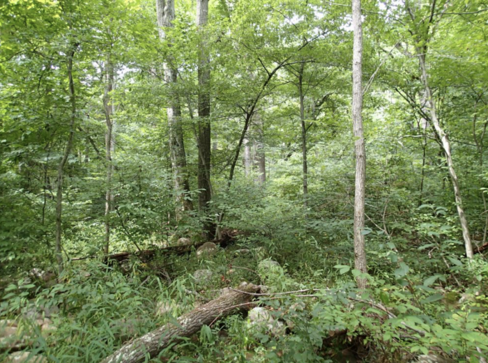
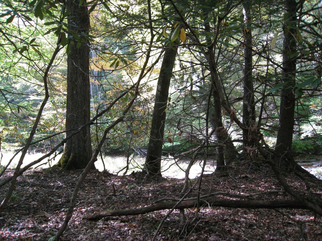
High Floodplain Forests and Woodlands comprise a diverse group of deciduous and mixed evergreen-deciduous associations dominated by trees more typical of upland settings. Dominant deciduous tree species include red oak (Quercus rubra), black oak (Quercus velutina), white oak (Quercus alba), bitternut hickory (Carya cordiformis), sugar maple (Acer saccharum) and American beech (Fagus grandifolia). In some stands there are scattered trees more typical of lower floodplains, such as sycamore (Platanus occidentalis) and river birch (Betula nigra). Dominant evergreen tree species in mixed stands include hemlock (Tsuga canadensis) along several rivers, or Virginia pine (Pinus virginiana) and eastern red-cedar (Juniperus virginiana) at two sites along the New River. The shrub and herb layers often distinguish these forests and woodlands from upland communities with similar tree composition. Shrubs which characterize different types include muscletree (Carpinus caroliniana), silverbell (Halesia tetraptera), great laurel (Rhododendron maximum), spicebush (Lindera benzoin), running serviceberry (Amelanchier stolonifera), and giant cane (Arundinaria gigantean). Herb layers often include a mixture of mesic upland and flood-tolerant species. Common herbs include white wood aster (Eurybia divaricata), Christmas fern (Polystichum acrostichoides), woodland stonecrop (Sedum ternatum), crooked-stem aster (Symphyotrichum prenanthoides), honewort (Cryptotaenia canadensis), golden ragwort (Packera aurea), and many others.
High Floodplain Forests and Woodlands occur in the upper zones of floodplains of rivers or in lower positions along smaller streams. Sites are generally not classified as jurisdictional wetlands. These landscape positions are subject to infrequent, low energy flooding and some sites are subject to rare high energy flooding. The Virginia Pine – Eastern Red-cedar Bedrock Terrace Woodlands along the New River are thought to have originated following catastrophic stand-replacing floods. Most other sites have evidence of more regular, low energy flooding. Landforms are fluvial and include boulder, cobble and sand accumulations and scoured bedrock. Giant Cane Woodlands may be relicts of more extensive canebrakes which were maintained, without tree cover, by fires intentionally set by Native Americans.
Animals that need these habitats
High Floodplain Forests and Woodlands are rare and no studies of their fauna are known. They are likely to provide habitat for many generalist species.
Distribution
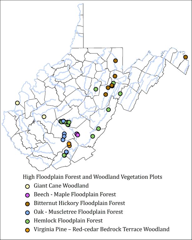
High Floodplain Forests and Woodlands are currently known along several rivers across West Virginia including the Bluestone, Buckhannon, Cheat, Ohio, Gauley, Greenbrier, Kanawha, New, Potomac, and Tygart Valley. Additional small patches are likely to occur along other rivers and their tributaries. Several place names in southwestern WV (Cane Branch, Cane Fork, Canebrake, Canebrake Branch, Caney Branch, etc…) may indicate locations of historical canbrakes.
Places to see and visit
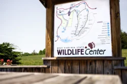
The Virginia Pine – Eastern Red-cedar Bedrock Terrace Woodland can be seen at Sandstone Falls in the New River Gorge National River. Consider a canoe trip (or a picnic) to see patches of Hemlock Floodplain Forest scattered along the Shavers Fork River in the vicinity of the Stuart Recreation Area. Patches of the Giant Cane Woodland can be observed along the creek at Greenbottom Wildlife Management Area.
Conservation issues
High Floodplain Forests and Woodlands were probably much more common prior to development of floodplains for human uses. Some of the best remaining occurrences are in deep gorges with narrow, rocky floodplains that have low potential for agricultural development. Roads and railroads along many rivers are placed at the upper limits of floodplains; these roads often occupy the former footprint of High Floodplain Forests and Woodlands, or they have degraded these habitats by changing hydrology or providing a pathway for invasions of non-native invasive plants. Flooding regime of the Virginia Pine – Eastern Red-cedar Bedrock Terrace Woodland may have been permanently altered when Bluestone Dam was built upstream. Restoration of canebrakes may require prescribed burning to reduce tree cover.
Classification
NatureServe Ecological Systems: Central Appalachian River Floodplain, Central Appalachian Stream and Riparian, South-Central Interior Large Floodplain, South-Central Interior Small Stream and Riparian
| USNVC Association Scientific Name [WV Common Name] | Code | G Rank | S Rank |
| Arundinaria gigantea Floodplain Woodland [Giant Cane Woodland] | CEGL003836 | G2? | S1 |
| Fagus grandifolia – Acer saccharum / Lindera benzoin Floodplain Forest [Beech – Maple Floodplain Forest] | CEGL005014 | G2G3 | S1 |
| Carya cordiformis / Carpinus caroliniana / Verbesina alternifolia Forest [Bitternut Hickory Floodplain Forest] | CEGL006445 | G2G3 | S1 |
| Quercus (rubra, velutina, alba) / Carpinus caroliniana / Maianthemum racemosum Floodplain Forest [Oak – Muscletree Floodplain Forest] | CEGL006462 | G1 | S1 |
| Tsuga canadensis – Quercus rubra – (Betula nigra) / Rhododendron maximum Floodplain Forest [Hemlock Floodplain Forest] | CEGL006620 | GNR | S2 |
| Pinus virginiana – Juniperus virginiana – Quercus stellata / Amelanchier stolonifera / Asplenium platyneuron / Leucobryum glaucum Bedrock Terrace Woodland [Virginia Pine – Eastern Red-cedar Bedrock Terrace Woodland] | CEGL008449 | G1 | S1 |
Key to Associations
- Successional deciduous woodlands with dense shrub layers dominated by giant cane (Arundinaria gigantea). Dominant trees include boxelder (Acer neguno) and black locust (Robinia pseudoacacia ). Known along the Kanawha and Ohio Rivers. = Arundinaria gigantea Floodplain Woodland[Giant Cane Woodland]
- Deciduous or mixed evergreen-deciduous forests and woodlands without giant cane in the shrub layer
- Mixed evergreen-deciduous forests and woodlands
- Deciduous forests
- Forests and woodlands dominated by Virginia pine (Pinus virginiana), eastern red cedar (Juniperus virginiana), and post oak (Quercus stellata). Known from just two sites along the New River. = Pinus virginiana – Juniperus virginiana – Quercus stellata / Amelanchier stolonifera / Asplenium platyneuron / Leucobryum glaucum [Virginia Pine – Eastern Red-cedar Bedrock Terrace Woodland]
- Forests codominated by eastern hemlock (Tsuga canadensis) with deciduous trees including red oak (Quercus rubra) tuliptree (Liriodendron tulipifera), and sweet birch (Betula lenta). Found along several rivers. = Tsuga canadensis – Quercus rubra – (Betula nigra) / Rhododendron maximumFloodplain Forest [Hemlock Floodplain Forest]
- Forests dominated by mesophytic hardwoods, including American beech (Fagus grandifolia), and sugar maple (Acer saccharum). Known from the Meadow River in Greenbrier County. = Fagus grandifolia – Acer saccharum / Lindera benzoinFloodplain Forest [Beech – Maple Floodplain Forest]
- Forests dominated by oaks (Quercus spp.) and/or bitternut hickory (Carya cordiformis)
- Forests dominated by bitternut hickory and red oak (Quercus rubra). Known in the Cheat and Potomac drainages in northern WV. = Carya cordiformis / Carpinus caroliniana / Verbesina alternifolia Forest [Bitternut Hickory Floodplain Forest].
- Forests dominated by red oak, black oak (Quercus velutina), and white oak (Quercus alba). Bitternut hickory often lacking. Mountain siverbell (Halesia teraptera) may occur in the subcanopy and tall shrub layers. Found along the New, Bluestone, and Gauley Rivers in southern WV = Quercus (rubra, velutina, alba) / Carpinus caroliniana / Maianthemum racemosum Floodplain Forest [Oak – Muscletree Floodplain Forest]